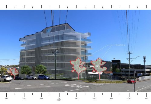
Conducting a thorough landscape assessment is a fundamental step in site planning and development. Understanding the environmental, social, and economic factors that shape a location can significantly influence the success of any project. To achieve this, various landscape assessment techniques are utilized to gather, analyze, and interpret data concerning the site’s characteristics and potential impacts. This article explores the essential methods used in landscape assessments, guiding professionals in making informed decisions for sustainable development.
Understanding Site Landscape Assessment
Site landscape assessment involves analyzing the physical and cultural aspects of a location to evaluate its suitability for specific uses. This process helps in identifying potential opportunities and challenges that may affect the development or preservation of a site. The assessment typically includes:
- Analyzing topographical features such as elevation and slope.
- Evaluating soil quality and composition.
- Assessing vegetation cover and biodiversity.
- Investigating hydrological patterns and water resources.
- Understanding human impact and historical land use.
Such comprehensive evaluation allows stakeholders to make strategic decisions that align with environmental sustainability and community needs. Read more about this topic to gain deeper insights into the process.
Techniques for Effective Landscape Assessment
Geographic Information System (GIS) Mapping
GIS mapping is a powerful tool for visualizing and analyzing spatial data. It allows professionals to overlay various data layers, such as land use, vegetation types, and infrastructure, to identify patterns and correlations. By integrating GIS technology, landscape assessments become more accurate and efficient, enabling better decision-making. Explore further insights here to understand how GIS is revolutionizing landscape assessment.
Remote Sensing
Remote sensing involves collecting data from satellite or aerial imagery to monitor and assess landscape changes over time. This technique is beneficial for detecting environmental changes, such as deforestation or urban sprawl, that may not be immediately visible on the ground. Remote sensing provides a cost-effective method for large-scale landscape assessment. Learn more in this detailed guide on the applications of remote sensing in landscape studies.
Field Surveys and Sampling
Field surveys are essential for collecting ground-truth data and verifying information gathered through GIS and remote sensing. These surveys often involve soil sampling, vegetation analysis, and water quality testing to provide a comprehensive understanding of the site’s current conditions. The combination of field surveys with other techniques ensures a holistic approach to landscape assessment. Find additional information here on conducting effective field surveys.
Benefits of Comprehensive Landscape Assessment
A thorough site landscape assessment offers numerous advantages, including:
- Informed decision-making that minimizes environmental impact.
- Identification of potential risks and mitigation strategies.
- Enhanced understanding of local ecosystems and biodiversity.
- Improved stakeholder engagement through transparent data sharing.
- Support for sustainable development goals.
Ultimately, landscape assessments are integral to responsible land use planning and development. By leveraging a combination of advanced techniques and traditional methods, professionals can ensure that projects are environmentally sound and socially beneficial. For those interested in delving deeper into landscape assessment methodologies, learn more in this detailed guide.
Conclusion
Site landscape assessment techniques are essential tools in the planning and development of sustainable projects. By applying methods such as GIS mapping, remote sensing, and field surveys, professionals can gain a comprehensive understanding of a site’s characteristics and potential challenges. This knowledge not only aids in making informed decisions but also supports long-term environmental stewardship. For those looking to enhance their expertise in site assessments, explore further insights here.